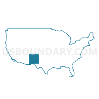
Albuquerque City (Northwest Mesa), Paradise Hills & Navajo Nation-Tohajiilee Chapter PUMA, New Mexico
About
Outline
%2c+Paradise+Hills+%26+Navajo+Nation-Tohajiilee+Chapter+PUMA%2c+New+Mexico_A280.png)
Summary
| Unique Area Identifier | 193441 |
| Name | Albuquerque City (Northwest Mesa), Paradise Hills & Navajo Nation-Tohajiilee Chapter PUMA |
| State | New Mexico |
| Area (square miles) | 419.92 |
| Land Area (square miles) | 417.88 |
| Water Area (square miles) | 2.04 |
| % of Land Area | 99.52 |
| % of Water Area | 0.48 |
| Latitude of the Internal Point | 35.16139860 |
| Longtitude of the Internal Point | -106.91345870 |
Maps
%2c+Paradise+Hills+%26+Navajo+Nation-Tohajiilee+Chapter+PUMA in New Mexico.png)
Albuquerque City (Northwest Mesa), Paradise Hills & Navajo Nation-Tohajiilee Chapter PUMA in New Mexico
Download
Graphs
Select a template below for downloading or customizing gragh for Albuquerque City (Northwest Mesa), Paradise Hills & Navajo Nation-Tohajiilee Chapter PUMA, New Mexico
%2c+Paradise+Hills+%26+Navajo+Nation-Tohajiilee+Chapter+PUMA%2c+New+Mexico_T0.png)
%2c+Paradise+Hills+%26+Navajo+Nation-Tohajiilee+Chapter+PUMA%2c+New+Mexico_T1.png)
%2c+Paradise+Hills+%26+Navajo+Nation-Tohajiilee+Chapter+PUMA%2c+New+Mexico_T2.png)
%2c+Paradise+Hills+%26+Navajo+Nation-Tohajiilee+Chapter+PUMA%2c+New+Mexico_T3.png)
%2c+Paradise+Hills+%26+Navajo+Nation-Tohajiilee+Chapter+PUMA%2c+New+Mexico_T4.png)
%2c+Paradise+Hills+%26+Navajo+Nation-Tohajiilee+Chapter+PUMA%2c+New+Mexico_T5.png)
%2c+Paradise+Hills+%26+Navajo+Nation-Tohajiilee+Chapter+PUMA%2c+New+Mexico_T6.png)
%2c+Paradise+Hills+%26+Navajo+Nation-Tohajiilee+Chapter+PUMA%2c+New+Mexico_T7.png)
Neighbors
Neighoring Public Use Microdata Area (by Name) Neighboring Public Use Microdata Area on the Map
- Albuquerque City (Central) & Bernalillo County (North Valley) PUMA, NM
- Albuquerque City (Southwest Mesa) & Bernalillo County (Southwest Mesa & South Valley) PUMA, NM
- Northwest New Mexico--Navajo Nation PUMA, NM
- Sandoval County PUMA, NM
- Valencia, Bernalillo (East Mountains) Counties & Isleta Pueblo PUMA, NM
Top 10 Neighboring County (by Population) Neighboring County on the Map
- Bernalillo County, NM (662,564)
- Sandoval County, NM (131,561)
- Valencia County, NM (76,569)
- Cibola County, NM (27,213)
Top 10 Neighboring County Subdivision (by Population) Neighboring County Subdivision on the Map
- Albuquerque CCD, Bernalillo County, NM (633,223)
- Rio Rancho CCD, Sandoval County, NM (113,761)
- Los Lunas CCD, Valencia County, NM (55,761)
- Belen CCD, Valencia County, NM (20,808)
- West Bernalillo CCD, Bernalillo County, NM (7,796)
- Cuba CCD, Sandoval County, NM (4,986)
- Laguna CCD, Cibola County, NM (4,459)
- Isleta Pueblo CCD, Bernalillo County, NM (2,489)
Top 10 Neighboring Place (by Population) Neighboring Place on the Map
- Albuquerque city, NM (545,852)
- Rio Rancho city, NM (87,521)
- North Valley CDP, NM (11,333)
- Corrales village, NM (8,329)
- Paradise Hills CDP, NM (4,256)
- Pajarito Mesa CDP, NM (579)
Top 10 Neighboring Unified School District (by Population) Neighboring Unified School District on the Map
- Albuquerque Public Schools, NM (667,445)
- Rio Rancho Public Schools, NM (89,033)
- Los Lunas Public Schools, NM (48,173)
- Grants-Cibola County Schools, NM (27,088)
- Cuba Independent Schools, NM (4,584)
Top 10 Neighboring State Legislative District Lower Chamber (by Population) Neighboring State Legislative District Lower Chamber on the Map
- State House District 29, NM (59,097)
- State House District 13, NM (52,751)
- State House District 44, NM (51,046)
- State House District 60, NM (41,212)
- State House District 12, NM (38,723)
- State House District 16, NM (31,852)
- State House District 17, NM (31,810)
- State House District 15, NM (31,051)
- State House District 23, NM (30,981)
- State House District 8, NM (28,864)
Top 10 Neighboring State Legislative District Upper Chamber (by Population) Neighboring State Legislative District Upper Chamber on the Map
- State Senate District 23, NM (84,821)
- State Senate District 11, NM (77,027)
- State Senate District 22, NM (60,988)
- State Senate District 10, NM (57,103)
- State Senate District 26, NM (52,067)
- State Senate District 29, NM (50,755)
- State Senate District 13, NM (48,892)
- State Senate District 30, NM (48,188)
- State Senate District 14, NM (42,652)
Top 10 Neighboring 111th Congressional District (by Population) Neighboring 111th Congressional District on the Map
- Congressional District 1, NM (701,939)
- Congressional District 3, NM (693,284)
- Congressional District 2, NM (663,956)
Top 10 Neighboring Census Tract (by Population) Neighboring Census Tract on the Map
- Census Tract 9406, Bernalillo County, NM (9,385)
- Census Tract 47.48, Bernalillo County, NM (9,190)
- Census Tract 47.17, Bernalillo County, NM (7,552)
- Census Tract 107.20, Sandoval County, NM (7,510)
- Census Tract 47.23, Bernalillo County, NM (7,278)
- Census Tract 47.41, Bernalillo County, NM (7,156)
- Census Tract 47.12, Bernalillo County, NM (7,147)
- Census Tract 47.46, Bernalillo County, NM (7,037)
- Census Tract 9747, Cibola County, NM (6,660)
- Census Tract 47.50, Bernalillo County, NM (6,522)
Top 10 Neighboring 5-Digit ZIP Code Tabulation Area (by Population) Neighboring 5-Digit ZIP Code Tabulation Area on the Map
- 87121, NM (76,721)
- 87114, NM (61,623)
- 87120, NM (58,023)
- 87105, NM (57,680)
- 87124, NM (51,404)
- 87031, NM (44,075)
- 87107, NM (31,183)
- 87104, NM (12,123)
- 87048, NM (8,682)
- 87026, NM (4,063)


%2c+Paradise+Hills+%26+Navajo+Nation-Tohajiilee+Chapter+PUMA%2c+New+Mexico.png)